
Tiree Bathymetry 2012
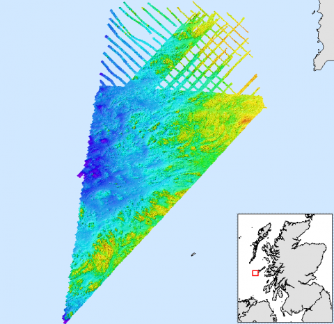
A bathymetric survey of an area south west of Tiree was carried out by Marine Scotland, The British Geological Survey (BGS) team and the Northern Lighthouse Board (NLB) in 2012. The bathy metric data was cleaned and tide corrected by BGS. The survey report available below provides more detailed information. The data was further processed by Marine Scotland Science using ESRI ArcGIS to produce additional data products. These layers highlight the different components of the seabed. Using a hillshade, aspect, slope and rugosity spatial analysis tools the change in slope and roughness of the seabed can be seen. these products have been packaged together into an ESRI layer package and a google earth package. A backscatter dataset, which provides information on the acoustic properties of the seabed has also been made available for download below.
An ASCII grid file has been included for those who do not wish to use the layer package.
Two potential cable sites were also surveyed and these have been included below too.
Links and Resources
| Type |
Link Title |
External Link |
|---|---|---|
| Marine Scotland Data Portal | Tiree Bathymetry Package | data.marine.gov.scot |