
UK Civil Hydrography Programme - Outer Hebrides
Bathymetric surveys from areas around Orkney and the Outer Hebrides have been carried out by the Maritime and Coastguard Agency (MCA) as part of the UK Civil Hydrography Programme. This bathymetric data has been processed by Marine Scotland using ArcGIS to derive a number of products to assist in the progression of a number of Scottish Government policies. The products are available to download in several formats. Further information regarding the UK Civil Hydrography Programme and other hydrography projects involving the MCA can be accessed from their hydrography webpages.
This data is not to be used for navigation.
This information page is part of the theme:
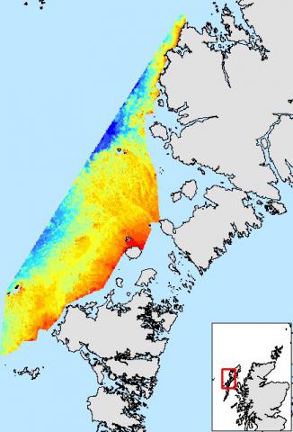
Outer Hebrides bathymetry - Copyright © Marine Scotland