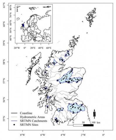
Scotland River Temperature Monitoring Network (SRTMN) - Predictions of river temperature and sensitivity to climate change
River temperature is an important control on the health of fish populations. Under climate change it is expected that river temperature will rise with potential consequences for fish populations. Therefore, rivers and fisheries managers require information regarding 1) where the maximum river temperatures occur (where is hottest) and 2) where is most sensitive to climate change (where may change the most). This information can then be used to decide where to plant trees. The layers presented here provide this information for Scotland. River lines in the layers were derived from a Digital Rivers Network licensed from the Centre for Ecology and Hydrology (CEH).
The details of modelling work that produced these layers can be found in the associated peer reviewed manuscript: Jackson et al (2018) ‘A spatio-temporal statistical model of maximum daily river temperatures to inform the management of Scotland's Atlantic salmon rivers under climate change.’ (see link under ‘Additional Information’ Tab).
The outputs of this work are illustrated as four layers on Marine Scotland Maps NMPi:
- SRTMN – Predictions of maximum daily river temperatures for the hottest day between July 2015 and June 2016.
- SRTMN – Predictions of maximum daily river temperatures for the hottest year in the last 20 years (2003).
- SRTMN – Predictions of the change in river temperature that would result from a 1°C increase in air temperature.
- SRTMN - Management priority on a scale of 1:9 where 1 is highest priority (i.e. high river temperature and high climate sensitivity) and 9 is lowest.


